![]()
Labor
Day Monument Valley
Muley
Point Fly-in
![]()
![]()
Labor
Day Monument Valley
Muley
Point Fly-in
![]()
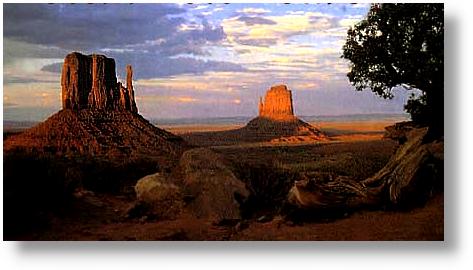
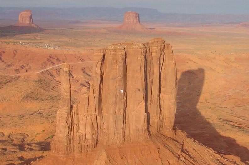
The Mittens at sunset in Monument Valley
Who:
Anyone who
is up for flying over heaven on earth....Monument Valley
What:
The trip
consists of flying some magical places rarely flown by hang gliding, paragliding
or ultralight pilots: Monument Valley and Muley Point.
Pilots should
be at least strong Hang II's and must have tow experience with sign offs
for aero and/or truck towing. There will be no tow training available
on this trip so have your tow sign offs in hand.
When:
Labor Day
weekend '03. We are leaving here late Wednesday afternoon and going
to Gouldings Trading Post (click here for Gouldings
info), which is two miles from Monument Valley Tribal Park. Gouldings
is a full service campground, hotel, showers, grocery store and a pool.
Hotel rooms are still available and reasonably priced for those who prefer
a less noisy crowd and comfort.
Rooms
The rooms
are $160 per night plus tax, camping sites are $15 per night. If you
have a trailer, camper or RV full hook ups are available.
Where: If my memory
serves me correctly, Monument Valley is a six hour trip to the border of
AZ and Utah. (click here for
map)
Conditions
permitting we hope to fly Monument Valley and Muley Point
Plan A involves flying Monument Valley on Friday and Saturday
conditions permitting. Currently we have permission to use the private
airstrip at Gouldings provided all pilots are current USHGA members and can
show evidence of a towing sign off. Please, tow rated pilots only. Sunday we will be flying Muley Point all day.
Monument
Valley Flight Plan:
Aerotowing
towing out of Gouldings airstrip and flying two miles directly over Monument
Valley where you should be able to get up. If the wind direction is
wrong we will go out into the desert and tow there. We are requested
NOT to land in the park but five miles north in a flat field. If you
do sink out and land in the park you will be flogged with wet sticks in a
smoke-filled hogan by naked Navajo virgins. . . (turn in sink)
Contact Info:
Brad Lindsay belindsay@earthlink.net
Corey Burke coreyb@commspeed.net
Laura
Salamone ahgc@northlink.com
![]()
Pictures
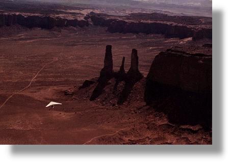
Photo by Jim Afinowich
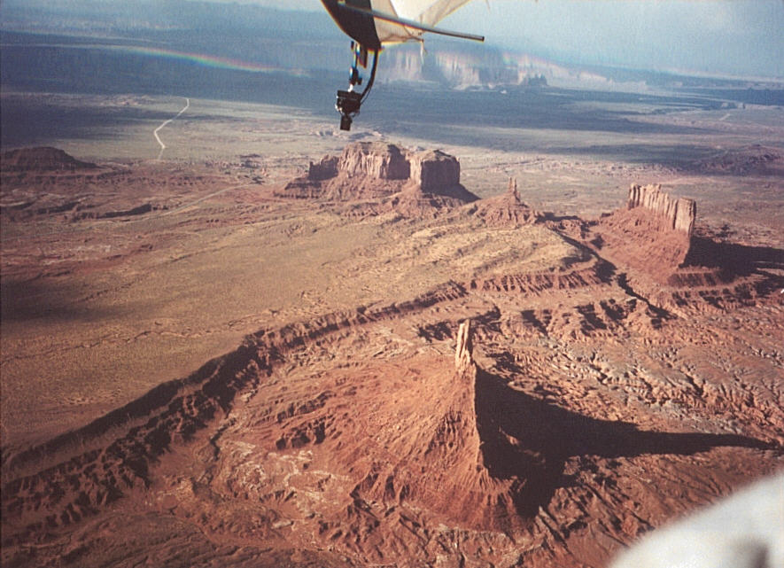
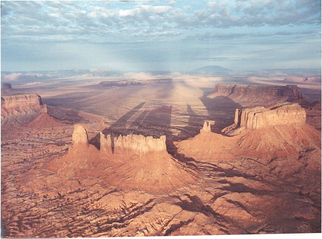
Just on the horizon from Muley Point is Monument Valley. For those trike pilots considering this adventure, it's a 30 minute, as the crow fly's XC from the road on Muley Point to Monument Valley...hour and a half by vehicle. Flying there is beyond words....a spiritual experience that leaves one breathless upon landing. The situation to fly there is a delicate one as there will be tourists in the park.
PHOTOGRAPHY
The Navajo's
charge BIG peso's to photograph in the valley ($2,000 per day), and they
should, it's unlike anything else on the planet. The reciprocity
of respect has and continues to be something I enjoy with the Navajo
Tribal Council. I will be VERY upset if any pilot violates the trust
I have established over the years with the Navajo decision makers.
Please, no published pictures.
![]()
 Does it get better than this?
Thermalling over the Mittens
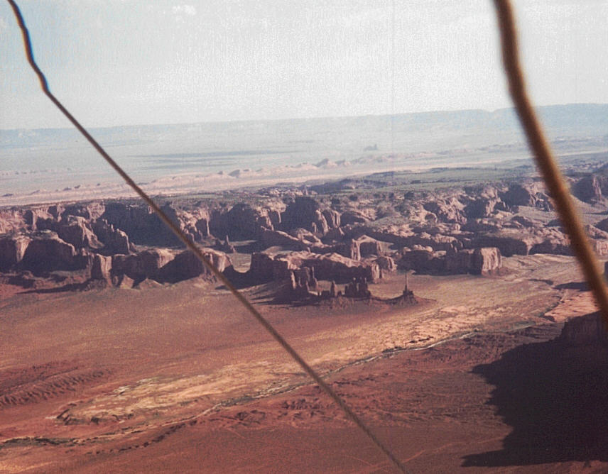
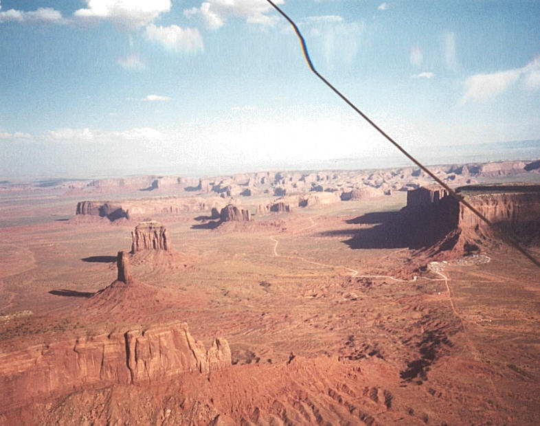
Looking North into the park with a view of the park center and Elephant Butte.
![]()
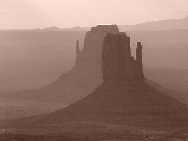
Mittens in the mist
Close up view of one of
the mittens
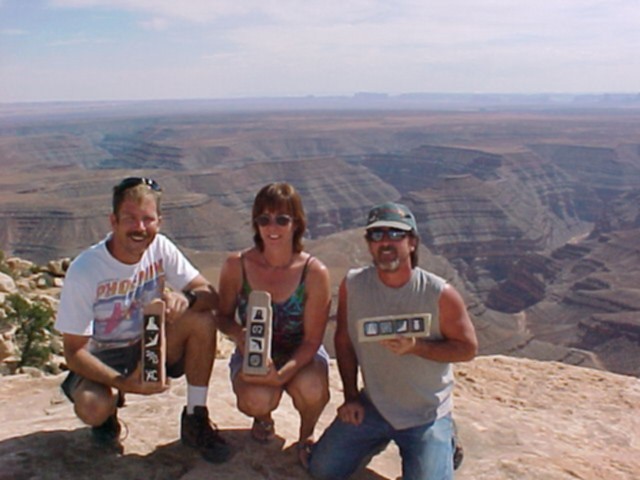
Last years winners: Todd,
Laura and Bob (bitchin' trophies by Corey Burke)
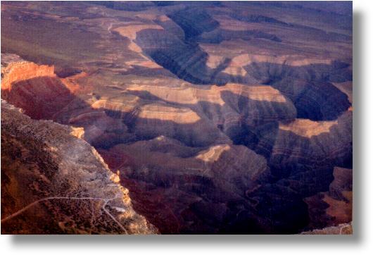
Muley Point and Goosenecks State Park
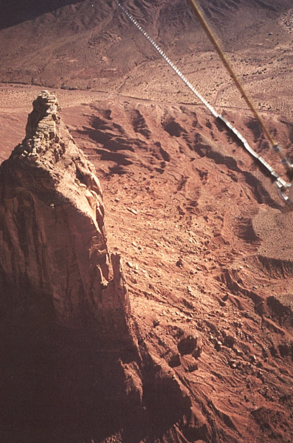
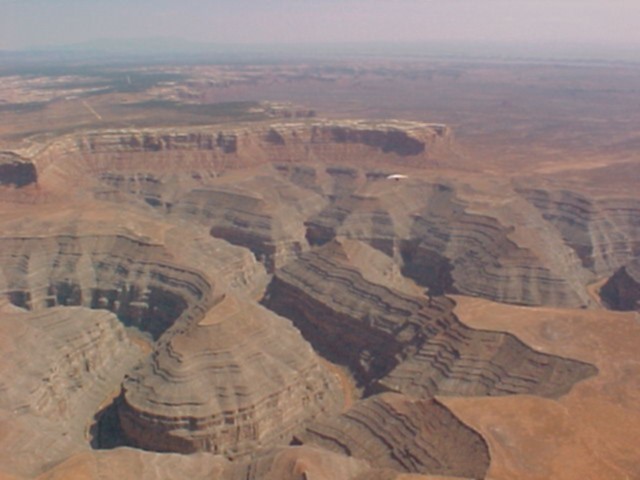
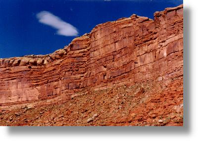
Muley Point is located in the Valley of the Gods just north of the AZ border in Utah. For map reference, look for Mexican Hat just north of the Utah/AZ border as the nearest form of life as we know it. This shot was taken looking south towards Monument Valley. Muley Point is the peninsula off to the left. Muley Point overlooks the Goosenecks National Monument and is just spectacular from the air. The road you see in the lower left corner runs two miles from the main road on top of the bluff to the cliff edge. PERFECT for towing hang gliders: long, smooth and when you release you are above this:
All photos by Brad Lindsay
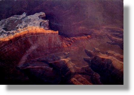
Muley Point and the Goosenecks. Although it doesn't look like much of an LZ, there are huge, flat, covered areas at the bottom next to the retrieval road. Here again the tow road can be seen terminating at the cliff edge.
![]()
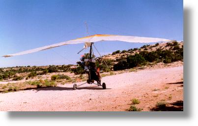
Corey heading for the top of Muley Point
Another angle of Muley Point taken from 7,000 agl. Here the retrieval road is visible as a light colored, horizontal line at the base of the cliff. The LZ's can be seen between the base of the butte and the Gooseneck canyons. It looks small from this vantage point but they are really big.
![]()
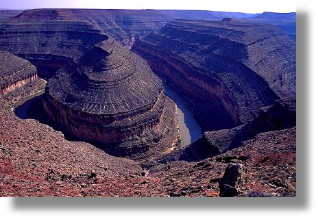
The view from the LZ at Muley point. Final approach is over this bend in the river. The San Juan River which carved the Goosenecks covers one mile of distance yet winds over five miles as it makes it's way through the park.
![]()
This is
the road on top and can be used to operate ultralights from and truck tow
hang gliders.
Foot launching has been done but so have near death experiences. Consult
your current karma kouncil for details.
![]()
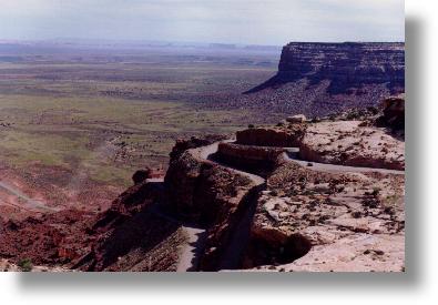
Photo by Brad Lindsay
This is
the switch back road up the face of Muley Point to the Mokey Dugway.
On the left the paved road to Mexican Hat is visible. It's about an
hour drive from the top by conventional transportation, ten minutes by trike!
Monument Valley can be seen on the horizon and is a 40 minute flight as the
crow flies.
![]()
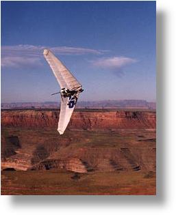
Photo by Doug Stiles
This is
the view from the launch and camping area on
Muley Point.
On the horizon is Monument Valley.
![]()
![]()
This is
a great trip and weather providing we will have many memorable and safe flights.
It's just under seven hours to Monument Valley without stopping to have the
gurls pee every 50 miles. How many days we will be flying in the park
will be contingent upon tourists and traffic. In the past the Navajo
police have stopped traffic on the main road so we can tow up on the road
to the visitors center. We have found many tow roads adjoining
the park with BIG LZ's and great views
Drop me
some email and let me know if you are going. More info to come so bookmark
this site.
Links:
Driving directions
to Kayenta: click
here
Driving directions
to Mexican Hat: click
here
Camping in
Monument Valley: click here
The Navajo
Nation: click here
Where to
buy a Sabre Trike: click
here
Make sure your camera gear is ready and test it before you go.
Hope to
see you at cloud base above Monument Valley
Page design
B Rad design group. All
material on this site free to copy and use at will.
Please mention
source of photos and links.